The Stawamus Chief (a.k.a. The Chief) is a popular hike near Squamish, BC.
It’s possible to climb The Chief year-round, depending greatly on the weather and temperature. I did it once in the middle summer, and now I can say I’ve done it in the winter as well.
Here’s the quick rundown of what it was like to hike The Chief in February.
Which way to climb
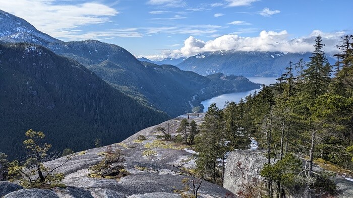
The Chief is a towering granite monolith, standing over 700 metres tall. There are officially three peaks, and a couple ways to get up to them from the trailhead.
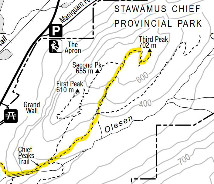
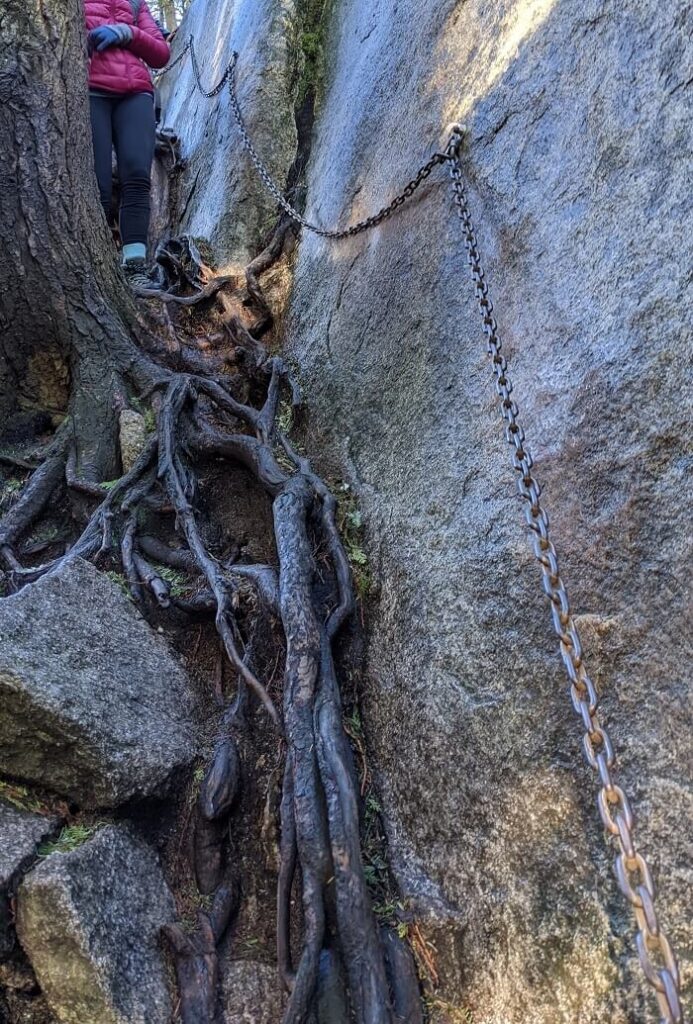
The most popular route seems to be the western route, which climbs past the first peak toward the second and third peaks. This route involves some adventurous climbing across narrow rock ledges and some very steep sections. There are metal chains attached to the rock to use as handholds, and even ladders in a few places. It’s not bad if you take your time, but when it’s busy, things can get crowded as it’s single-file. By mid-morning, there are people heading both up and down, causing mini-traffic jams.
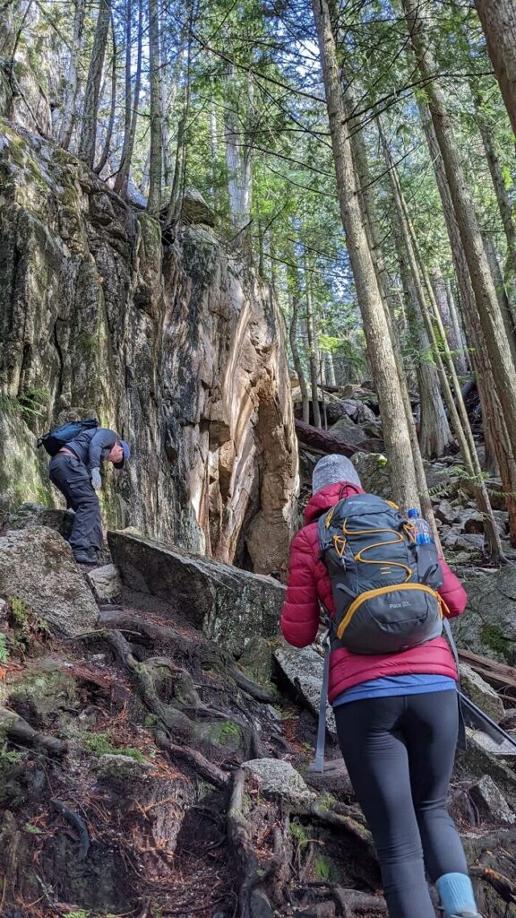
The alternate route, which has been all but empty both times I’ve climbed The Chief, goes up the backside towards the third peak. This route is a more typical hiking trail; while steep, it’s walking over roots and small boulders surrounded by trees.
We decided to take the back way.
The trip
We drove from Burnaby, about an hour’s drive from the parking lot. Starting just after 9:00 am, there were already quite a few cars in the lot. While it was February, it was also a long weekend and presumably going to be a day of perfect weather; a fair crowd should have been predictable.
The first part of the hike up The Chief is stairs—lots of ‘em.
Stopping often to catch our breath, we reached the main junction in reasonable time. From that point, the front route offers more stairs, and then ladders. The back way is no less steep, but at least avoids the bottlenecks.
Indeed, our entire way from the junction to the third peak, we saw fewer than a half dozen people. The ascent took approximately three hours at a leisurely pace. The third peak was just as quiet as the trial up—not a soul around the entire time we spent up there.
One thing we did eventually see was snow. In shadowy holes and gulleys, there were still small piles of hardpack snow. Some of it was hard enough to walk across; some was hard enough to trick you into stepping on it and sinking up to your knee.
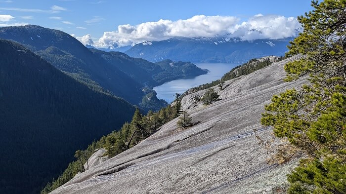
From the third peak, we decided to walk across the top of The Chief toward the second peak. Why backtrack when you can make a loop and see some new stuff?
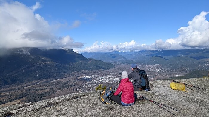
By the time we reached the second peak, we started to encounter more and more people—dozens of them.
On the way down, we dodged any serious traffic jams. While there were plenty of people on the way up, we never had to wait long at the various one-way ledges and ladders.
Part way down the steepest section is another junction, with the option to go up to the first peak. From a distance, this seemed the most popular, but I’ve never been up. It’s the shortest of the three peaks, and the busiest. The view from second and third peaks is plenty beautiful.
By the time we reached the parking lot after a total of about 4.5 hours, it was full—with plenty of folks just starting even in the mid-afternoon. Would they even finish before dark?
Hiking The Chief in February was a great time, and much easier that I’d expected. Of course, we got almost absurdly lucky with the weather and trail conditions. One isn’t always so lucky hiking in shoulder seasons.
Either way, it’s best to treat it with the respect it deserves.